Red Rabbit
-
Content Count
7,074 -
Joined
-
Last visited
-
Days Won
31
-
Tonto, Coconino, Apache-Sitgreaves, Prescott NF Fire Restrictions
Red Rabbit replied to Red Rabbit's topic in The Campfire
Add Prescott NF to the list with Stage 1 fire restrictions beginning May 21. https://www.fs.usda.gov/r03/prescott/newsroom/releases/prescott-national-forest-implement-stage-1-fire-restrictions-may-21 -
Tonto, Coconino, Apache-Sitgreaves, Prescott NF Fire Restrictions
Red Rabbit replied to Red Rabbit's topic in The Campfire
Apache Sitgreaves will start Stage 1 on May 19. https://www.fs.usda.gov/r03/apache-sitgreaves/newsroom/releases/apache-sitgreaves-national-forests-will-implement-stage-1 -
Tonto, Coconino, Apache-Sitgreaves, Prescott NF Fire Restrictions
Red Rabbit replied to Red Rabbit's topic in The Campfire
Arizona State Trust lands are under Stage 1 fire restrictions as of May 15, https://dffm.az.gov/newsroom/fire-restrictions -
Tonto, Coconino, Apache-Sitgreaves, Prescott NF Fire Restrictions
Red Rabbit replied to Red Rabbit's topic in The Campfire
Coconino County has generally duplicated the CNF restrictions. Where I live in Kachina Village is in Coconino county and follows the county restrictions. I imaging something will be posted next week. Flagstaff is entering Stage 1 restrictions May 21 also. So check your county and city restrictions. -
Tonto, Coconino, Apache-Sitgreaves, Prescott NF Fire Restrictions
Red Rabbit replied to Red Rabbit's topic in The Campfire
Coconino NF Stage 1 Restrictions begin on May 21. https://www.fs.usda.gov/r03/coconino/newsroom/releases/coconino-nf-enter-stage-1-fire-restrictions-may-21 -
Tonto, Coconino, Apache-Sitgreaves, Prescott NF Fire Restrictions
Red Rabbit posted a topic in The Campfire
https://www.facebook.com/TontoNationalForest/posts/pfbid0Jrrv7BX23kbkgspmLiLpKm26T3maVaKmaRKyPuvoGzSxLAcCeayx1hHt6iuTP6LVl?__cft__[0]=AZbsNPksf13BSbn8snTcA97Zr0kP4RQ2ThfLWWFX6aoAdY_1ykckcxqAhcS7zKwuYCl1BYehLzP8TIX80NLuzQUfIdmylOiTLym3LgfdQ8-VAtG99G31sdbWZMacq1_p-clMgjIP51YBCYDxBVAbQ5SsYh5Cr0__STg55mBqUScCmnmXzwXOBy53rCs1jOVCwck&__tn__=%2CO%2CP-R With increasing fire danger across Arizona, Tonto National Forest officials will implement emergency stage 1 fire and recreational shooting restrictions for the entire forest beginning Friday, May 15, at 8 a.m. Visit the Tonto National Forest website to learn more about stage 1 fire restrictions, including recreational shooting restrictions, and exemptions to the rule: https://www.fs.usda.gov/r03/tonto/fire/fire-restrictions. Prohibited acts when visiting the Tonto during stage 1 fire restrictions: Building or using a fire outside a Forest Service installed metal or concrete fire structure within a designated developed site such as campgrounds or picnic areas. A designated site has permanent fire rings or grills maintained by the Forest Service. A stove fire must be inside a fully enclosed metal stove or grill with a chimney at least 5 feet tall and a spark arrestor with ¼‑inch mesh. Smoking, except inside an enclosed vehicle or building, at a developed recreation site, or in a cleared area at least 3 feet wide that is free of flammable material. Discharging firearms, including air rifles or gas guns. Emergency stage 1 fire restrictions also include recreational shooting restrictions to protect the public, wildland firefighters, and our natural resources from the risk of a recreational shooting-caused ignition due to Very High fire danger conditions across the forest. Restrictions will remain in effect until Forest Service officials determine that conditions have changed sufficiently to reduce the risk of human-caused wildfires. Apache-Sitgreaves https://www.fs.usda.gov/r03/apache-sitgreaves/newsroom/releases/apache-sitgreaves-national-forests-will-implement-stage-1 Coconino https://www.fs.usda.gov/r03/coconino/newsroom/releases/coconino-nf-enter-stage-1-fire-restrictions-may-21 -
I will start a topic - 8 deer bonus points
Red Rabbit replied to Big or Bust's topic in Rifle hunting for Coues Deer
8 points would not get you into the bonus pass for the December hunts in 23 or 29. Last year, Dec 29 required 9 BP. But you could always roll the dice in hopes for drawing in the 1-2 pass. Units 23 or 29 would add some interest and challenge if you wanted different new territory. -
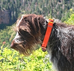
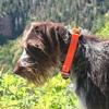
Another Whiskey for my Friend
Red Rabbit posted a topic in Small Game, Upland Bird, and Waterfowl Hunting
I wonder what label Rica preferred? Facebook (link is to a music reel about GWP bird dog) -
This is what Google AI came up with on how that works: Yes, state game and fish departments receive matching Pittman-Robertson (PR) funds for the hunting licenses they sell, though it is not a dollar-for-dollar match. The program operates on a 75% federal / 25% state matching basis, effectively creating a 3-to-1 ratio where license revenue helps unlock federal dollars. How the Matching Process Works Source of Funds: The PR Act (Federal Aid in Wildlife Restoration Act) is funded by an 11% excise tax on firearms, ammunition, and archery equipment, and a 10% tax on handguns. The Match Requirement: State wildlife agencies must pay 25% of the cost of approved wildlife conservation projects, which is then reimbursed by the federal government for the remaining 75%. Role of License Sales: States almost exclusively use revenue generated from selling hunting licenses, permits, and stamps to pay their 25% matching share. Reimbursement Structure: A state covers the full cost of a project and is later reimbursed by the U.S. Fish and Wildlife Service. The Role of License Numbers in Funding License sales play a dual role in PR funding: Providing the 25% Match: The cash from license sales is used as the state's required share. Determining Apportionment: The formula for distributing PR funds is based 50% on the land area of a state and 50% on the number of paid hunting license holders in that state. Therefore, selling more licenses increases the state's share of the federal excise tax funds and provides the revenue needed to match those funds.
-
WY is still better than AZ towards NR in that AZ requires one to purchase a hunting license to apply for the draw or bonus point. In WY, a NR can buy a PP if they do not draw, or just a PP after the draw. In AZ, a NR has to buy a $160 hunt&fish license and then a $15 application fee, whether they want to apply for a hunt or just get a bonus point
-
Commissioners vote to increase non-resident preference point prices | Wyoming Game & Fish Department While the $30-40 increase is not much spread over a year to stay in the game, I predict many will be looking to cash in their points. I have been building antelope points since my last hunt for a better unit while the 2023 winter decimation, work, and other hunts have kept me on the side.
-
Dave Mason, co-founder of Traffic and celebrated Rock & Roll Hall of Famer, died peacefully at age 79 on April 19, 2026 Dave Mason & Joe Bonamassa – “Dear Mr. Fantasy” Official Music Video
-
I have not been in several years as some of the towns which I used to go to died out. I had the most fun with a 22LR as opposed to my 22-250. I have some ELY high velocity hollow points waiting to test and see if they are more accurate than the CCI mini mags. Your kids should have a fun time if you find a good town that offers plenty of shooting.
-
I had only 6 points. In looking at the draw report, there were people with 1, 2, 3, 5 points who drew. If one is not in the max point 20% bonus pass pool, still apply. https://azgfd-portal-wordpress-pantheon.s3.us-west-2.amazonaws.com/wp-content/uploads/2026/03/27091508/2026-M-Bonus-Point-Report.pdf
-
Guess I have been looking on the wrong side of the trees all of these years.