apache12 Report post Posted May 23, 2014 So does anyone have maps or online map systems that list more springs than others? Or are their old books that document springs? I'm sure just beating feet and looking for green cottonwoods or sycamore trees is proven. Just lookin for some technology to get me started Share this post Link to post Share on other sites
maximus Report post Posted May 23, 2014 i use the garmin basecamp and has a lot of watersources and info. Share this post Link to post Share on other sites
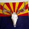
AZLance Report post Posted May 23, 2014 Wearing the rubber off of your boots will help... these are a few that I found this year that are not on maps... 6 Share this post Link to post Share on other sites
Sneaker Report post Posted May 23, 2014 Hiking is the only way to go! It always surprises me how much hidden water we have in this dry state. 2 Share this post Link to post Share on other sites
Swivelhead Report post Posted May 23, 2014 e scouting is ok but there is no substitute for boot leather. 1 Share this post Link to post Share on other sites
apache12 Report post Posted May 23, 2014 Ok so beating feet sounds best. Share this post Link to post Share on other sites
CouesPursuit Report post Posted May 23, 2014 I have found several springs similar to those pictured above and many of them come and go each year. Had one in the superstitions that had water 3 feet deep with flowing water one year in early June and was dry the following year during the January hunt. Same thing experienced in other areas to a lesser degree. My point being that they change frequently and most of the ones on the maps are ones that have had some human influence to keep free water, many times a cement trough or other store and supply device. And I'm in the map/technology business, there isn't a map out there that shows secret springs that others aren't well aware of. IMHO. To find the "hidden" springs as mentioned in the OP, get boots on the ground after studying Topo maps really well. There are indicators that can get you looking in the right direction. 3 Share this post Link to post Share on other sites
mattys281 Report post Posted May 23, 2014 The trouble with maps too is that they are often old and can be inaccurate. I was pointed to a couple in a wilderness area via topo map only to find that there'd been fires, followed by flooding and landslides which had completely buried the spring I was looking for. You gotta check them out yourself. Share this post Link to post Share on other sites
naturegirl Report post Posted May 23, 2014 I found a seep a few months ago. It was an area that I've hiked a lot of times, but in the past it was always the wrong time of the year for me to see it. Share this post Link to post Share on other sites
apache12 Report post Posted May 24, 2014 Ok so beyond the obvious green tree signs or cuts in a mtn that would show erosion any other geological signs that you look for? Share this post Link to post Share on other sites
NeckRoast Report post Posted May 29, 2014 There is a section pinned in coues biology about this a lot of good info there 1 Share this post Link to post Share on other sites
JLW Report post Posted May 29, 2014 So does anyone have maps or online map systems that list more springs than others? Or are their old books that document springs? I'm sure just beating feet and looking for green cottonwoods or sycamore trees is proven. Just lookin for some technology to get me started here are some that are marked. guess it depends on how far from the road they are if they get hit alot. http://www.mytopo.com/locations/features.cfm?s=AZ&c=007&type=Spring James Share this post Link to post Share on other sites